
The Colony Neighbors Source Map
A neighbors search in The Colony has several layers, and each proves something different. A parcel viewer establishes the spatial relationship of land in The Colony. DCAD can provide current parcel fields, such as a situs address and legal description. A recorded plat or deed can establish a subdivision or title relationship. Association certificates identify an organization, not its members. Start with the source that answers the limited question at hand and avoid turning any one layer into a household roster.
| Source | What it establishes around a block | Access and limit |
|---|---|---|
| DCAD and city GIS | Parcel geometry, situs, R number, and mapped location | Public map data; approximate and informational |
| DCAD parcel card | Recorded owner, mailing field, legal description, and parcel identifiers | Current public roll; owner is not necessarily occupant |
| County Clerk plats and deeds | Lot, block, addition, easement, or transfer relationship | Advanced search, counter, or copy request |
| Texas HOA certificates | Association name, location, type, and management record | Owner-supplied data; no member list |
| My Voter Portal | An individual registration lookup with identifying inputs | Not a public block roster; protected records can be suppressed |
| Neighborhood Watch | A city public-safety program | Program contact only, not participant names |
For The Colony neighbors, use terms such as “bordering parcel,” “same recorded subdivision,” “recorded owner,” or “city map places.” An owner may receive mail elsewhere, and a parcel may be vacant, held by an entity, or used as a common area. Those conditions prevent a parcel result from proving who lives there.
The Colony Neighbor Parcel Boundaries
The City of The Colony GIS provides street, zoning, school, city-limit, and council-map context. Denton County GIS adds cadastral, floodplain, political-boundary, transportation, and voter-precinct layers. DCAD GIS supplies parcel research: turn on Parcels under Layers, search or click a property, note the number over the parcel as the R number, and open the parcel detail. GIS is useful for locating relationships, but neither the city nor DCAD presents it as a site-specific survey.
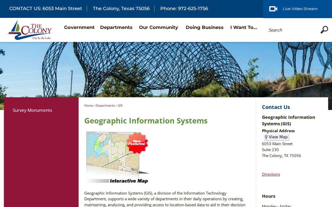
The map view supplies a starting geometry for neighbors research. Confirm the selected parcel's legal description and situs in the property record before drawing a conclusion about a block or subdivision. The recorded date helps establish that map context. Keep the map retrieval date with each parcel note.
Map The Colony Neighbor Parcels
Map a block in The Colony from the target parcel outward. The required sequence is address to R number, adjacent parcel identifiers, current situs and legal description, then the recorded plat or deed. No documented exact radius or buffer control was located for the city map, so an adjacent-parcel method is more accurate than claiming a fixed distance around an address.
- Locate the target address in DCAD GIS or City GIS and save its parcel or R number.
- Click only the parcels that physically border it and record each parcel identifier separately.
- Check the current situs and legal description for each parcel in DCAD, keeping the owner and mailing fields distinct.
- Use the County Clerk plat or real-property record to test whether the parcels share a recorded addition, lot pattern, or easement.
- Check an HOA certificate and city or county boundary layer only when those sources fit the parcel relationship.
For the longer record trail along a named road, use the The Colony streets directory. The block method stays narrow: it tests immediate parcel relationships without claiming a complete street list of occupants.
The Colony Neighbor Plat Records
In the County Clerk Advanced Search, use the Plats or Real Property department and search the subdivision or addition name, block, lot, and legal-description terms copied from DCAD. A recorded plat can explain why two nearby parcels are in the same addition. A deed can establish the recorded transfer and its legal land wording. Inspect the instrument image and recording details before describing an easement, restriction, or common-area relationship.
Parcel geography can cross an administrative boundary. The Colony is primarily in Denton County, yet an association result bearing The Colony can appear in Collin County. Compare county, city, ZIP, legal description, and map layer before attaching an association or record to a parcel. A branding name alone is not enough.
Note: A mailing recipient, management entity, or recorded owner may differ from the person who currently occupies a neighboring parcel.
The Colony Neighborhood Records
The Texas HOA management-certificate search has name, county, city, ZIP Code, and association-type filters. It can add a community layer after the plat check, but it is not a directory of neighbors. The state says the information is supplied by associations and may be incomplete or out of date. A result can establish an association's listed location or management record, not private membership.
| Listed association example | Result details to verify |
|---|---|
| Austin Ranch Townhomes HOA | Denton County, The Colony, 75056, COA |
| Lakeridge Townhomes | Search result; confirm county, city, ZIP, and POA type in its certificate |
| Westport Lakeview Villas | Search result; confirm the certificate and its parcel relationship before use |
| Camey Place Owners or Creekside at Austin Waters | Search result; association presence does not establish parcel membership |
| Cascades (The Colony) | Collin County result requiring a boundary check |
The certificate can list a legal name, county, city or ZIP, association type, management company or agent, certificate date, and PDF. Keep the association evidence separate from personal records and avoid treating a certificate as proof that a particular parcel is covered.
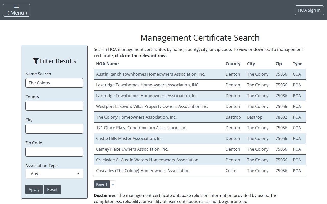
The state search helps test community geography after parcel records are checked. Its completeness disclaimer means an absent result cannot prove that no association exists.
The Colony Neighbor Boundary Records
City limits, school zones, council districts, subdivisions, postal labels, floodplain layers, and voter precincts do not always match one another. City GIS and county GIS can place a parcel in the relevant geographic layers, while a recorded plat supplies the legal subdivision relationship. Keep each label in its own field instead of flattening them into one neighborhood name.
The Colony’s land history adds another reason to check the map. Streets and first families date to 1974, incorporation followed in 1977, and Eastvale consolidated in 1987. Earlier records may use Eastvale, Peters Colony, Bridges Settlement, rural Denton County, or acreage language. The historical name should remain visible when it is the record's own wording.
The Colony Neighbors Record Comparison
Official records and compiled neighbor categories answer different questions. A parcel or plat has a named keeper, a legal purpose, and fields that can be checked against the source. Compiled categories may be convenient, but their associations can be stale, incomplete, or detached from the parcel itself. Neither category identifies every household member or supports unwanted contact.
| Official parcel and community records | Compiled neighbor categories |
|---|---|
| Can establish parcel boundaries, recorded ownership, legal descriptions, and listed association details. | May suggest a connection, but the source date and matching method can be unclear. |
| Can be checked at the custodian, through the instrument, or against a map layer. | Need independent confirmation from an official parcel, plat, or certificate. |
| Still do not prove present occupancy or authorize contact with a person. | Do not become stronger evidence merely by combining multiple results. |
The Colony Neighbor Safety Records
The Denton County jail and bond records landing page is a custody-record channel, not a tool for identifying neighbors. A jail or bond record does not establish a current address, household, parcel relationship, or community presence. Do not use a result to infer where someone lives.
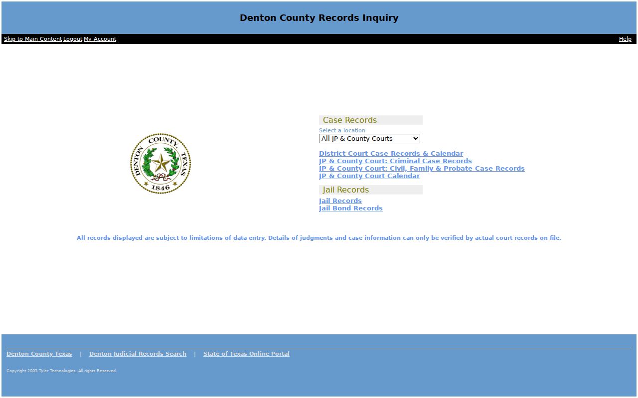
The county screen documents that custody records have a separate official route. It does not add a residential layer to a block search.
The Texas DPS Sex Offender Registry also has its own official search route and statutory rules. It is not a substitute for parcel records, an HOA certificate, or a current residency finding. Use the registry only for its stated public-safety purpose and read the official terms and cautions before relying on any result.
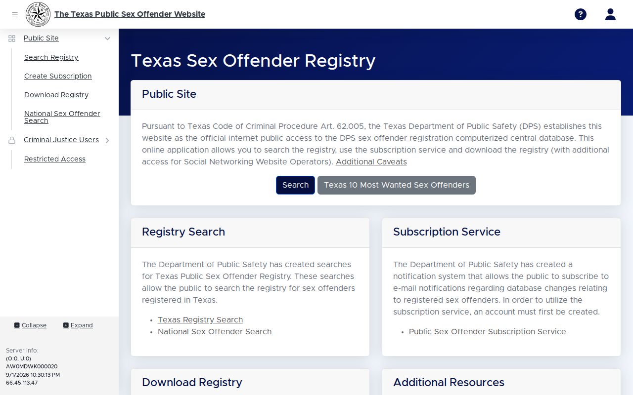
The registry image is included as a source-role distinction. It provides no basis to identify a neighbor, state occupancy, or facilitate personal contact.
The Colony Neighbor Privacy Limits
Texas Address Confidentiality Program participants can use a substitute mailing address, and Texas election rules protect certain residence addresses. A voter display can show *** for protected information. My Voter is an individual lookup requiring identifying inputs, not a public block roster. Utility and motor-vehicle data are not public resident indexes. A non-match never proves that a person lacks a local connection.
A request under the Texas Public Information Act goes to the government body that holds existing records, not to a general neighbors search. The Colony City Secretary accepts public-records requests by mail, in person, fax, e-mail, and an online form. Ask for a specific existing city record and expect either prompt production or contact within ten business days when more time is needed. A responsive record can still require redaction, and a request does not convert private membership, protected addresses, or private household details into public data.
Lawful use. Use The Colony neighbor records for civic and property context, not to watch, pressure, stalk, harass, or harm anyone. Texas law protects confidential addresses and prohibits stalking and harassment.